March 30, 2016 Staff Report
The Department of Transportation has released its annual NYC Bike Map displaying the 1,000 miles of New York City’s bike network, plus markers of where potential new bike routes could appear in western Queens.
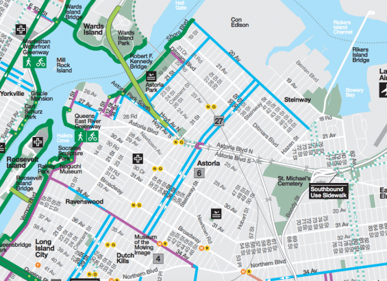
The map shows color-coded protected bike paths, bike lanes, shared lanes and signed routes throughout the five boroughs, as well as Citi Bike stations and bike shops. It is available digitally here and printed maps will be released in April.
The DOT has promised 15 more miles of protected bike lanes to be constructed throughout the city in 2016 – the most ever in a calendar year, according to the agency.
These include the bike lanes planned in the vicinity of Astoria Park on Shore Boulevard, 20th Avenue and Hoyt Avenue North, which were approved by Community Board 1 in February.
The 2016 map also marks potential new bike lanes and bike routes that the DOT has identified with colored dots. These are lacking in Astoria except for a sliver of road where Astoria Boulevard meets Hoyt Avenue.
However, the DOT is also at work on a bike route that would stretch along 31st Avenue from Vernon Boulevard to Astoria Boulevard, which has yet to receive Community Board approval.
Some errors have been identified with the map so far and it is evidently still a work in progress, with the DOT responding to at least one resident via Twitter that it has been updated.
Once the print version is available residents can call 311 for a copy. They will also be available at libraries, schools and bike shops throughout the City.
